🌱 Hear the latest about Memphis Botanic Garden's Living Collections Inventory process at our June 14th, 2022 Coffee Chat, registration is free. Click here to register.
Case Study: Preserving Biodiversity and Institutional Knowledge at the Memphis Botanic Garden
| “The loss of biodiversity is permanent, with climate change one of the factors leading to this loss. We have about 12 million species on earth—not counting bacteria and other microorganisms—and we have given names to fewer than two million…Despite this gaping hole in our knowledge, we must act to preserve as many of the existing species while there is still time to do so.”
- Dr. Peter H. Raven, President Emeritus of the Missouri Botanical Garden |
(Did you know that we have another software that supports most types of biological collections and material for natural history museums?) 🌱It is called Corema. |

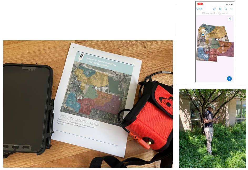
Data collection setup using ESRI Field Maps and an EOS Arrow 100. Photos courtesy of Magnolia Maps
From mind to database: choosing the right tools
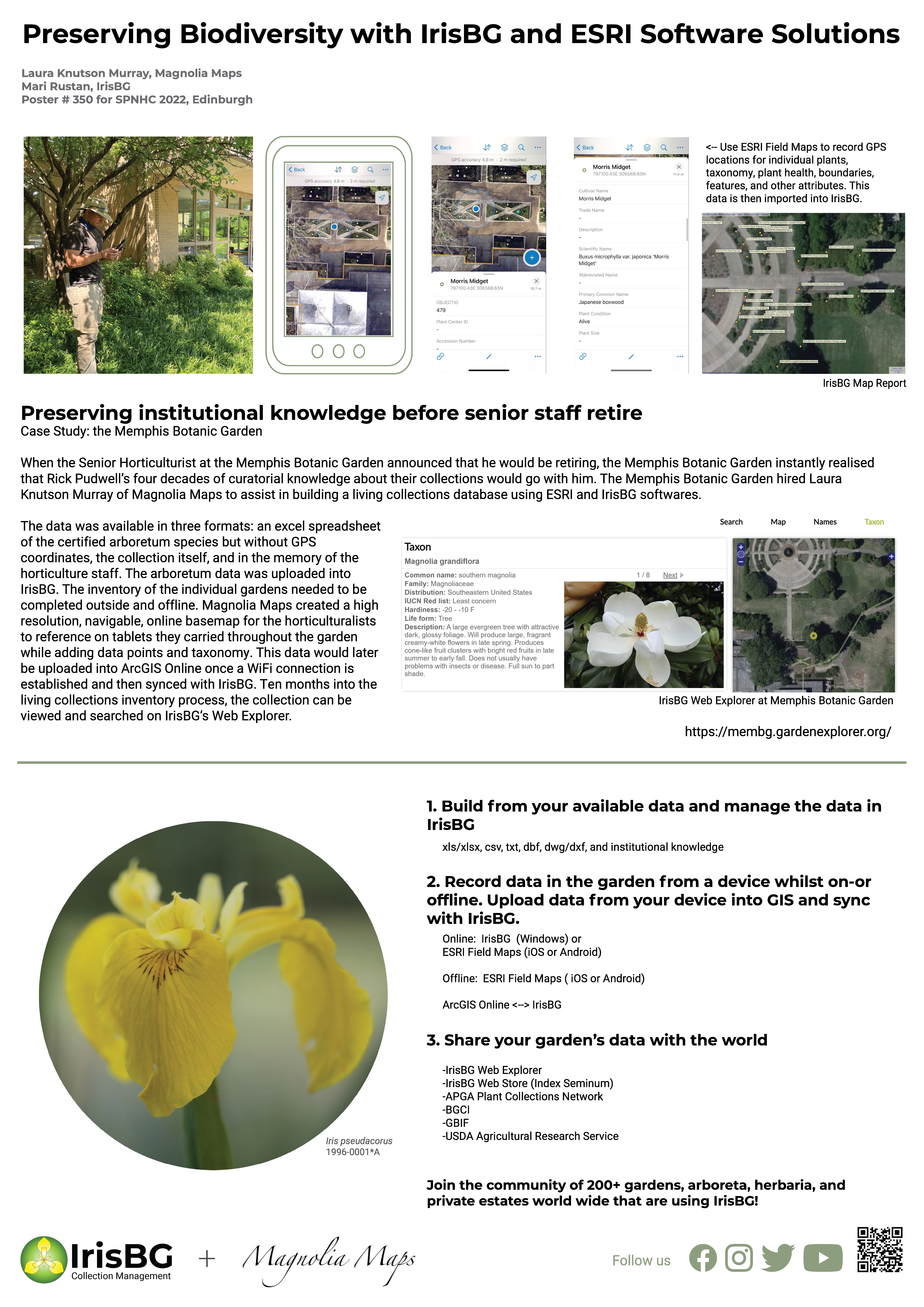
Memphis Botanic Garden invested in IrisBG and ESRI Software Solutions and with that investment, they managed to successfully preserve not only the biodiversity of their living collections but its institutional knowledge. The Director of Horticulture, Rick Pudwell, gave a year of notice that he was going to retire. In order to minimize loss of curatorial knowledge, the Living Collections Committee sought to catalogue all the individual gardens; prioritizing where Rick had had the most influence during his tenure.
The Memphis Botanic Garden selected IrisBG as their database solution and their public-facing Web Explorer site invites visitors to search the Garden’s Collections.
Data collection using Field Maps
The horticulturalists had 12 months to set up a workflow for the inventory and catalogue the priority gardens. Laura Knutson Murray set up tablets with the ESRI’s Field Maps app to use offline in the garden. The geography of the garden had to be set for reference locations. These polygons were drawn on the map and center points of these polygons are used as a reference in IrisBG's locations. The polygons display on the map while the inventory is being taken and serve as a reference layer.
The horticulturalists were able to record coordinates of individual accessions, Taxon Names, and reference locations while out in the garden. The Field Map App was set up to have a fillable form for each accession and allowed for photos to be taken of accession item during the inventory. The data is synchronized to the cloud when the tablet is back under wifi and then is imported into IrisBG.
Want to learn more about the flow of data between IrisBG and ArcGIS Field Maps?
Sign up for our June 14th 2022 Coffee Chat or email laura@irisbg.com if you have questions.


Comments
0 comments
Please sign in to leave a comment.